
Global health consortium offers innovations to alleviate food insecurity, environmental degradation, and disease outbreaks
Published January 18, 2023
Leading experts in satellite imagery, machine learning, and health metrics are joining forces to illuminate emerging threats to health and well-being.
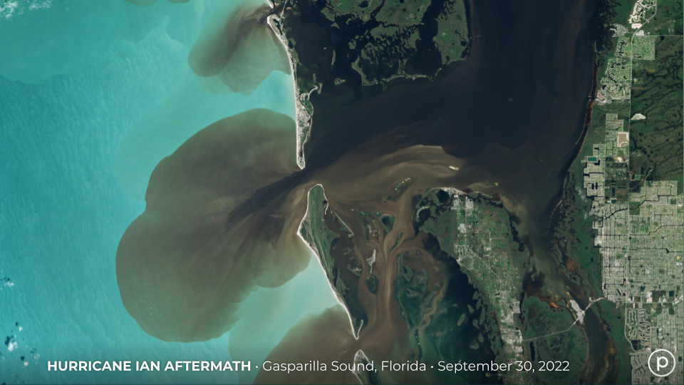
Photo Credit: Planet Labs PBC
Leading experts in satellite imagery, machine learning, and health metrics are joining forces to illuminate emerging threats to health and well-being.
Planet Labs PBC, based in San Francisco, California; the Institute for Health Metrics and Evaluation (IHME) at the University of Washington in Seattle; and the AI for Good Lab at Microsoft, based in Redmond, Washington, announced during the World Economic Forum that they are collectively committed to analyzing high-resolution satellite imagery to generate current data that will help monitor health and population impacts associated with climate change, food security, and sustainability.
“We have been collaborating separately with IHME and Planet, supporting policymakers worldwide on a range of issues. Bringing the three partners together is a key next step in our journey,” said Juan Lavista Ferres, Microsoft Vice President and Director of the AI for Good Lab.
Over the next 30 years, rising temperatures in highly populated regions of the world will cause significant health loss and prompt people to migrate en masse. Understanding how many people will move and where they will go will be essential to avert humanitarian crises such as food shortages, epidemics, and infrastructure collapses.
Some emerging threats may harm populations in similar ways around the world, while others, such as climate change or food system changes, may have specific local impact. This work will help to detect and anticipate emerging threats and mitigate the health impact.
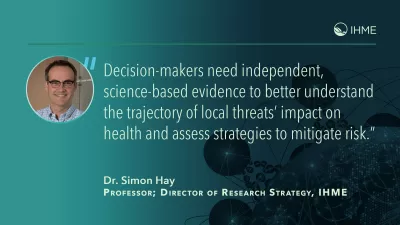
“Decision-makers need independent, science-based evidence to better understand the trajectory of local threats’ impact on health and assess strategies to mitigate risk,” said Dr. Simon Hay, Director of Research Strategy and Professor of Health Metrics Sciences at IHME, whose research has focused on the spatial and temporal aspects of diseases and the implementation of disease control.
“This level of global monitoring will be critical for health in the future,” said Dr. Christopher Murray, IHME Director. “We are committed to providing the findings needed to forecast the future impacts of environmental events, changes in the food supply, and migration on health worldwide.”
This work builds on an ongoing engagement between the three organizations. Early in the pandemic, the Microsoft AI for Good Lab worked with IHME to share expertise and software support for IHME’s COVID-19 modeling efforts.
Used by governments and global private sector companies, IHME’s model proved to be highly accurate in predicting trends in COVID-19 and impacts of social distancing, mask use, and vaccinations.
“We will be leveraging these models to develop novel assessments of population strengths and potential vulnerabilities to better detect emerging health threats,” said Dr. Ali Mokdad, Chief Strategy Officer for Population Health at the University of Washington and Professor of Health Metrics Sciences at IHME.
Early in the partnership, Planet, Microsoft, and IHME focused on counting cars in parking lots in specific health care settings globally to detect health patterns.
“The results were interesting enough that we knew that there was much more that could be done,” said John Kahan, Special Advisor to IHME on Data Science and former VP and Chief Data Analytics Officer at Microsoft. “It just made sense to train IHME’s leading-edge analytics on the best-in-class satellite imagery provided by Planet to go beyond infectious diseases and answer questions on climate, food, and health more broadly.”
Each organization brings complementary analytic skills and tools to the initiative. Together, they will analyze Planet’s timely, frequent satellite imagery combined with environmental, health, and population data to better understand where populations are and to discern climate trends, translating the information into actionable scenarios to guide decision-making.
“Our organizations share a common view of the need to illuminate the intersection of health, climate, and food security,” said Andrew Zolli, Planet’s Chief Impact Officer. “Through the consortium, we aim to turn satellite imagery and big data into actionable findings for decision-makers, helping invisible challenges become visible, and visible challenges become actionable.”
IHME is actively seeking new funding sources to expand on the work already underway. The goal is to address three questions:
- Where do people live and where will they move as conditions change?
- How is land being used, especially related to food?
- What are emerging and endemic diseases that pose regional or global threats?
More about the organizations involved in the consortium:
![]()
![]()
![]()