
Understanding where people live and how climate change may impact them can help us plan for and respond to emergencies
As global temperatures rise, the negative effects are felt disproportionately in areas where resources are already constrained.
Global surface temperature change relative to the period 1850–1900 in degrees Celsius

*Shared Socioeconomic Pathways (SSPs) are climate change scenarios of projected socioeconomic global changes up to 2100. Read more.
With rising temperatures, wasting in children due to malnutrition is expected to increase.
Percentage of children under 5 experiencing childhood wasting* in low- and middle-income countries

*Child wasting refers to children who are too thin for their height and is the result of recent rapid weight loss or the failure to gain weight. Read more.
IHME, Planet Labs, and Microsoft’s AI for Good Lab are working together to generate up-to-date estimates of population density at highly local levels.
Population distribution in Kenya with a zoomed-in view of central Nairobi

High-resolution maps overlaid with climate data will allow us to understand where people are living in severely climate-stressed zones.
Population exposure to extreme climate stress* in Kenya, 2015–2100**
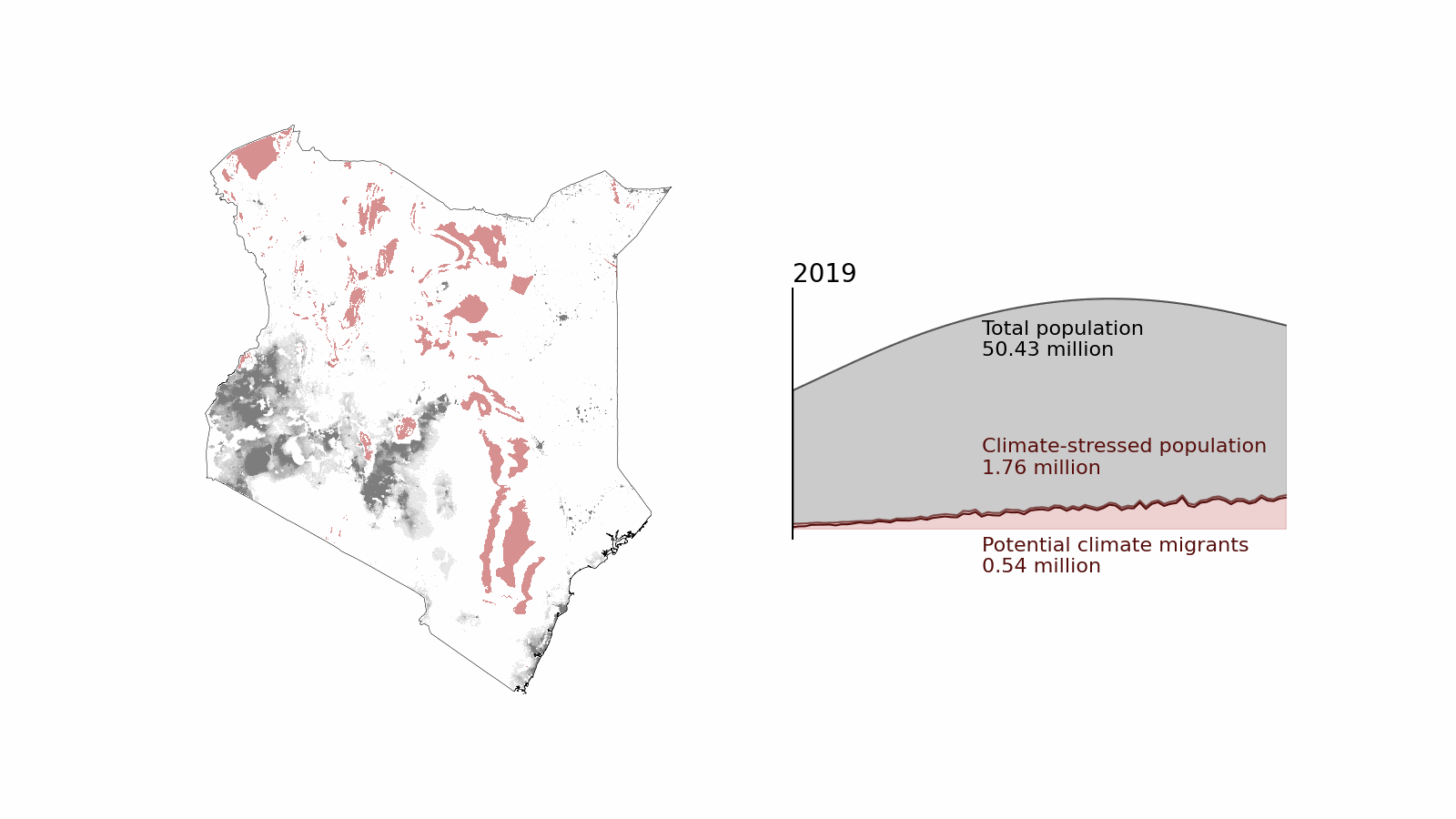
*IHME uses a human climate niche analysis to determine a country-specific climate threshold for extreme climate stress.
**The forecasts assume SSP2 - RCP4.5 conditions: moderate future greenhouse gas emissions coupled with some climate protection measures in place.
Detailed population maps create a foundation for data layers that will inform anticipatory action.
Paired with population data, other datasets will be layered on to address strategic questions.